Using Satellite Images
Before visiting a lake you’ve never skated on before, it can be useful to search for recent satellite images of the lake. Satellites pass over New England every few days, and if the skies are cloud-free, crystal-clear images can be obtained.
As of November 2025, some of the best images can be found on the Sentinel Hub EO Browser by following these steps:
1. Go to this link to see New Hampshire’s Lakes Region: https://apps.sentinel-hub.com/eo-browser/?zoom=11&lat=43.62663&lng=-71.58417
If this isn’t your area of interest, pan and zoom to the correct area.
2. Satellite websites are constantly changing. During the 2025-26 ice season, you can sign up for a free account by entering an email address and password. After a 30-day free trial you’ll have to upgrade to a paid account, which costs 30 Euros a month (about $35). If you don’t want to upgrade, you can create another free account using a different email address, or you can switch to the Copernicus browser, which is free. I’ve never used Copernicus, so I can’t show you how to use it, but you can learn it on your own.
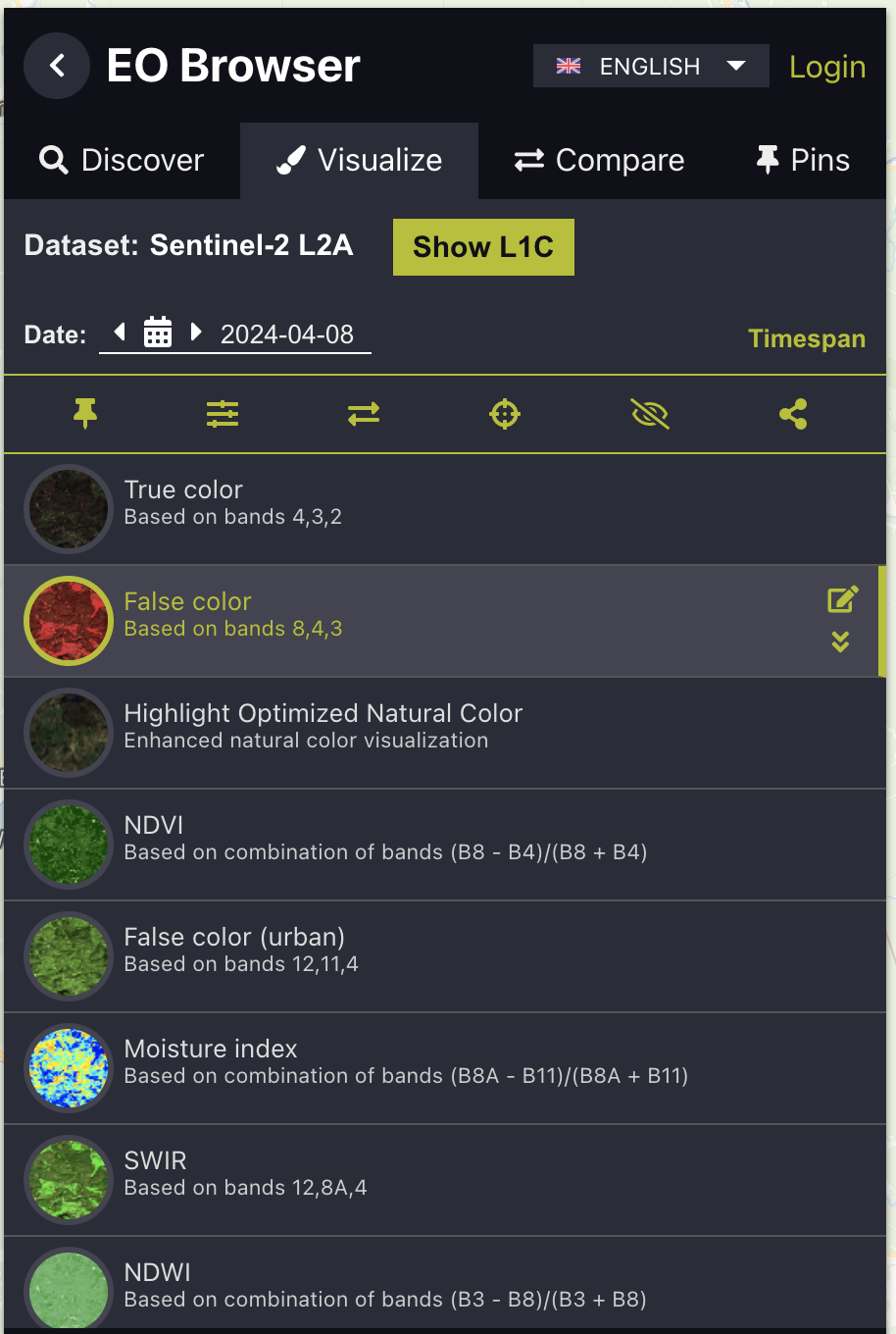
3. In the screenshot on the upper right, note that satellite Sentinel-2 is selected by default, with a blue check mark next to it. This satellite usually provides the highest-quality images, so don’t change the selection. Toward the lower left of the screen, you’ll see a large green button labeled ‘Search’ . Click it.
4. A list of satellite image ‘thumbnails’ will be displayed on the left side of your screen. Each image has a date, with the newest at the top. Select the most recent cloud-free image and click ‘Visualize’. If none of the displayed thumbnail images are cloud-free, go up to the ‘Date’ field and use the back-arrow or the calendar icon to go back in time until you find a cloud-free image. Then click ‘Visualize’.
5. Click ‘False color’ to view an enhanced image that increases the contrast between land and water, snow and ice, and even differentiates between black ice and gray ice.
6. You’ll see an image like the one in the lower right. Practice identifying the following types of features:
a. DARK RED - Forested land
b. SOLID WHITE - Snow-covered fields, or snow-covered ice
c. LIGHT GRAY & LIGHT BLUE - Gray ice. Lighter shades are weak snow ice with a high air content; darker shades are solid dark gray ice with fewer air bubbles)
d. DARK GRAY - Older black ice. It may be crisscrossed by thin gray or blue lines, which represent cracks or pressure ridges.
e. SOLID BLACK - Open water or new black ice. It is impossible to distinguish between them in a satellite image, so on-site inspection is required.
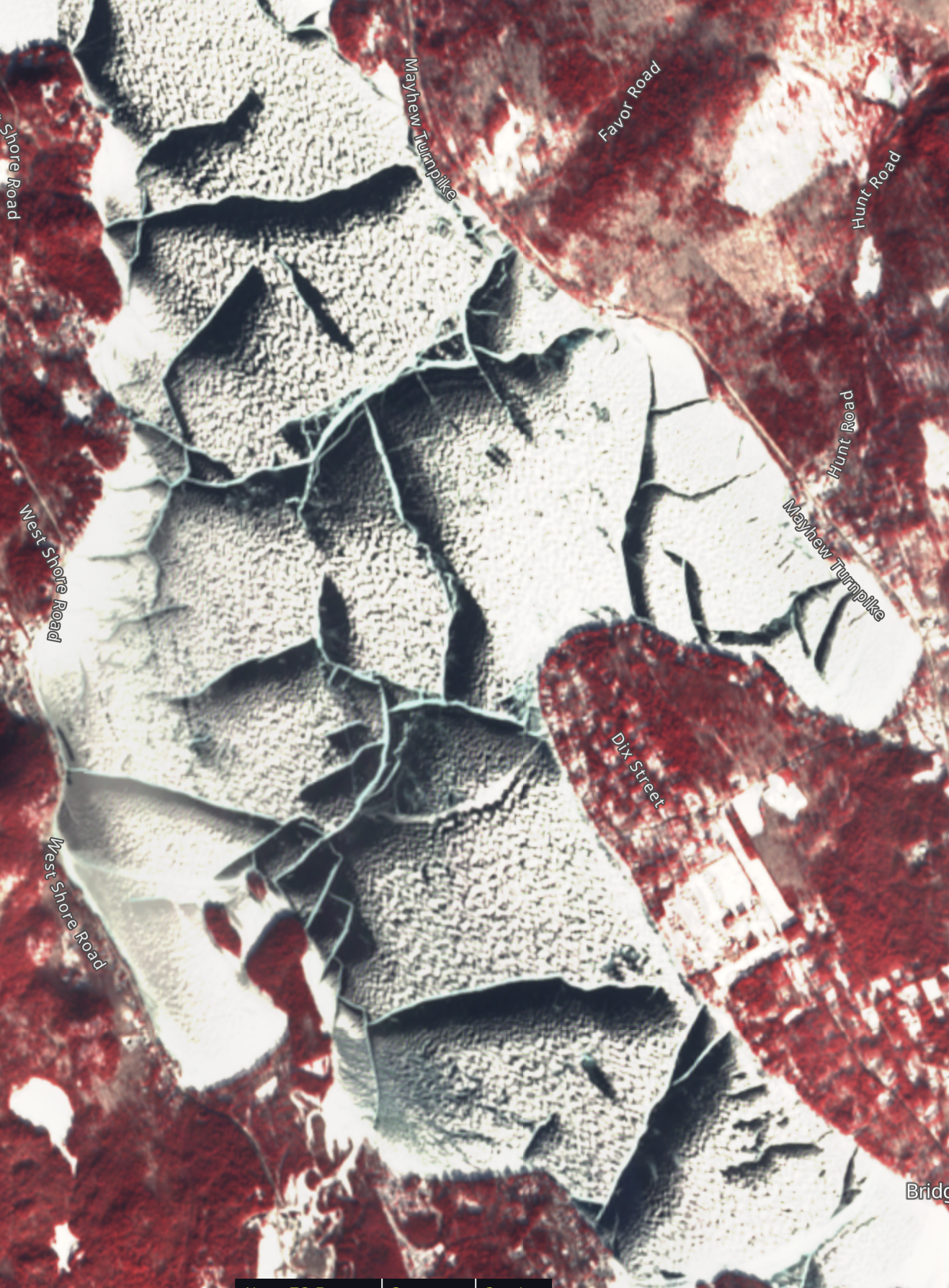
Below left: False-color image of Newfound Lake, New Hampshire, January 21, 2025. Black strips are black ice. Adjacent light blue lines are healed pressure ridges (gray ice). White areas are snow-covered. Red is forested land.
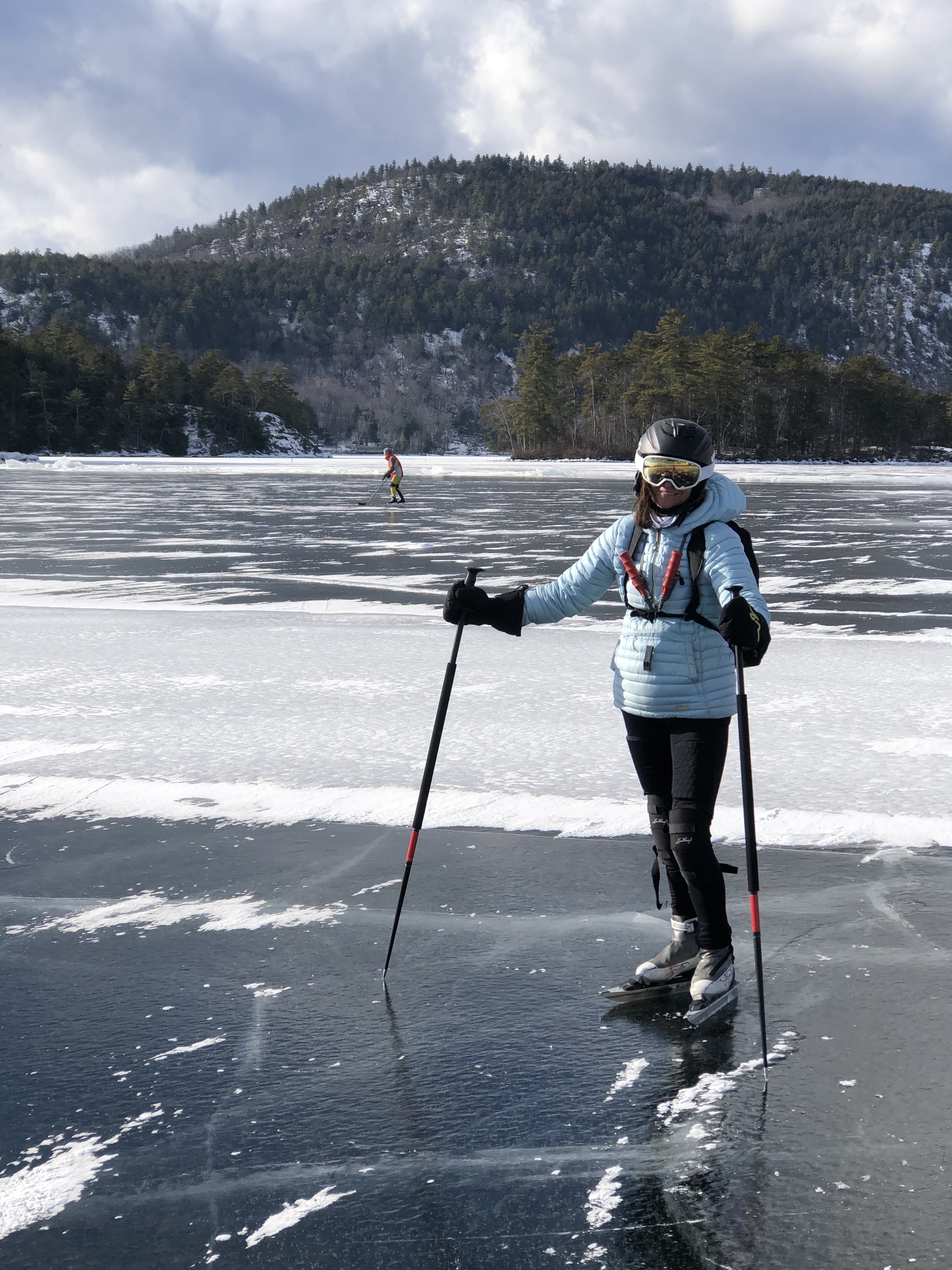
Below right: On a strip of black ice next to a healed pressure ridge. This pressure ridge was bordered by black ice on both sides, but most ridges had black ice only on the downwind (southeast) side.
Far right: False-color image from Fort Peck Lake, Montana, January 26, 2025. Just like Newfound Lake above, Fort Peck was crisscrossed by pressure ridges with wide swaths of black ice adjacent to their south and east sides. The cause of this phenomenon on both lakes: Fierce northwest winds and blowing snow. When the snow blew across an active pressure ridge with water oozing out of it, the snowflakes melted and turned to slush, then eventually froze into gray ice. Meanwhile, on the downwind side of the pressure ridge, the wind scoured off the snow and exposed the black ice.

Screenshot above: Initial view showing a variety of satellite data sources, with the Sentinel-2 satellite pre-selected. (Click the green ‘Search’ button)
Screenshot below left: ‘Thumbnail’ views of the three most recent satellite images. The uppermost image, from April 8th 2024, has near-perfect clarity with zero cloud cover. The middle and lower images, from just two days earlier, are useless because cloud cover is 98% to 99%. (Select an image and click ‘Visualize’, or scroll down to see older images.)
Screenshot below right: Selecting an enhanced color scheme to accentuate the contrast between different types of ice. (Click the red circle labeled ‘False color’)

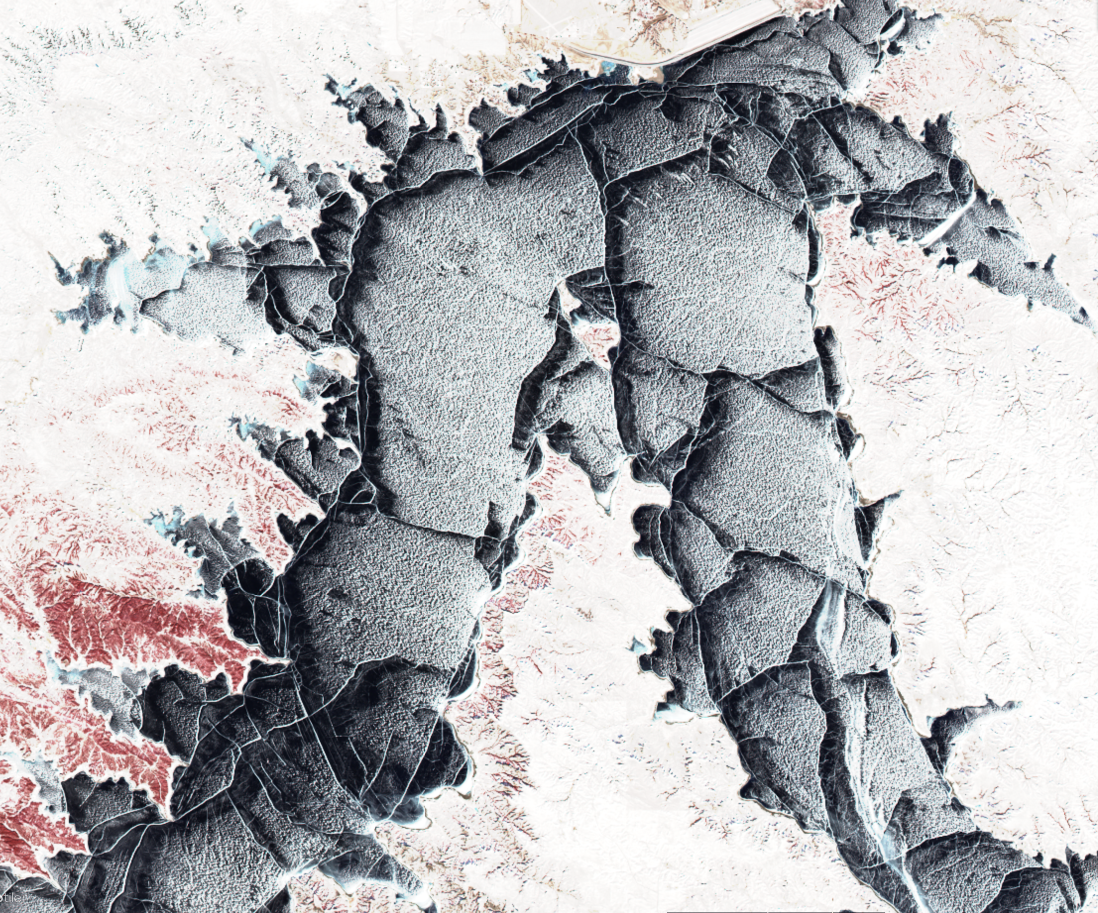
Below: False-color image of northern Lake Winnipesaukee, New Hampshire from early February 2024, showing older gray ice in light blue, newer black ice in dark gray, open water in solid black, forest land in red, and snow-covered fields and ponds in white.